Saturday, February 9, 2013
The Preparation
Bon Air. Who’s ever heard of Bon Air?
Well, at least 808 people (as of the 2010 census) have heard of it. They’re the few, and hopefully proud, residents who call this neighborhood home.
If you’re impressed that we’re now referencing census data, then you know exactly how we feel. We were talking the other day about extending our research routine per proof to include census data. Within minutes, we stumbled upon an incomparable resource that is not only helpful for us, but interesting for absolutely anyone wanting to know more about the city and its neighborhoods.
Unbeknownst to us, and maybe to some of you, the City of Pittsburgh has been busy since 2010 putting together its first ever Comprehensive Plan, with a mission to “enhance Pittsburgh’s quality of life by determining the effective and efficient use of its natural systems, infrastructure, cultural assets, recreational amenities, and economic resources.” It is a “game plan for making policy, attracting investment and determining the most effective use of tax payer dollars.” The plan began in 2010 and is known as PLANPGH. The plan is so vast. There is a 5-year timeframe in place just to conduct the research and, then, there is a 20-year timeline for execution. PLANPGH rests on the data made available through a couple related sources – PGHSNAP (neighborhood data source; click to watch a minute-long video description) and PGHGIS (an extremely detailed and layered mapping system).
If you’re going to check out just one piece of this, check out the PGHSNAP interactive .pdf. We’ve added this vital resource to our list of often-used sites, so it’s there when you want to explore some neighborhood data!
Anyway, back to those 808 Bon Airians. On this particular day, we wanted to get a feel for what it’s like to be them.
We learned that Bon Air had its very own T-station and, so, we decided to travel like a resident might. Of course, while Bon Air residents likely leave their vehicles in their driveways and take the T into the city for work and play, we did just the opposite. We might be the only people ever to commute downtown from our home, park our car in a garage, and then take the T to Bon Air simply to enjoy the neighborhood.
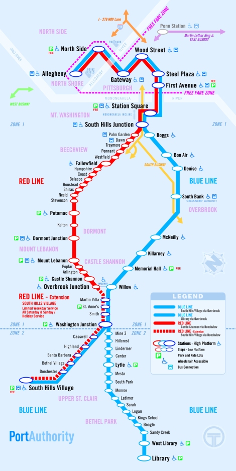
We’ve taken the T within city limits, but this was our first time branching outward. This matters because, within city limits, payment is not required. It’s absolutely free to ride between the North Shore and the First Avenue stop downtown as pictured here:
Heading outside of that free fare zone wasn’t a big deal – it’s affordable – except that we didn’t know the process for payment. If you’re in the same boat, we can help you out, but that wasn’t the only part of our learning curve.
Apparently this mural was mesmerizing enough to distract us from boarding the correct train. Thinking we were on our way to Bon Air, our first ride went backwards, under the Allegheny River, and to the North Shore. Whoops. Fortunately, it only took a few minutes and that’s a testament to the system’s efficiency. Upon boarding, though, we did ask the conductor about the payment process and he informed us that we’d pay when we left the train in Bon Air. It was a $2.50 trip per person each way, but there are weekly, monthly, and annual options that provide significant savings per trip.

South Hills Junction – there’s something romantic, or at least pleasingly nostalgic, about such a sight!
Well, the romanticism of it all must have distracted us much like that mural in the station; about 11 minutes into the journey from the Gateway Plaza T-stop, we zoomed right passed our destination. Whoops (again)! We tugged on the “let-us-off” alert rope and the conductor halted the train at the next stop. We paid our fares, jumped off the train, and quickly realized we had a pretty long walk back to Bon Air!
The Neighborhood Stroll
The silver lining in our mishap was that we had the opportunity to walk through the southernmost portion of the neighborhood, near Nobles Lane, which we otherwise wouldn’t have had occasion to see. Take a look at the neighborhood map:
Bon Air is a quaint residential neighborhood isolated geographically because of its peak position atop a hill. Surrounded by Brookline, Beechview, Mt. Washington, Beltzhoover, Knoxville, and Carrick, it’s interestingly only accessible by road through Knoxville; there simply aren’t very many streets in this neighborhood!
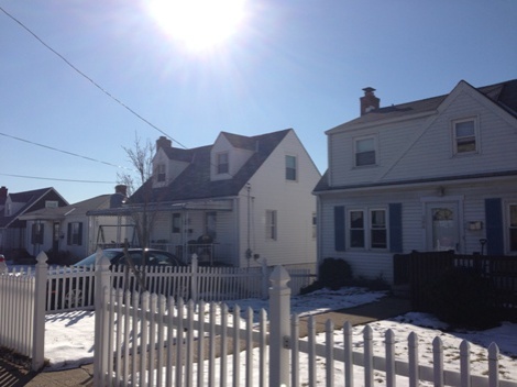
The neighborhood is hilly, but it’s reasonable to walk the entire plan. We lucked out with a sunny day in early February that made for a very pleasant stroll.
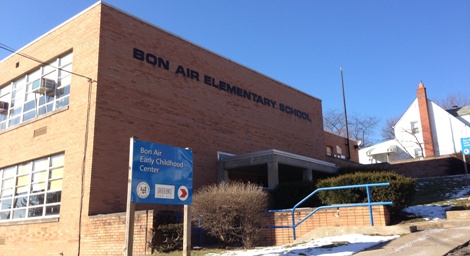
We are hesitant to say for sure, but we don’t think there is a single business in Bon Air. It’s all residential (aside from an early childhood center). This is the polar opposite of some of our recently explored neighborhoods, but we welcomed the charming layout and hung onto the notion that this was a very positive thing. The Bon Air Civic Association describes the environment as “country living in the city,” which helps to tell the story, but we wouldn’t go that far. There aren’t horses, steer, cowboy hats, or hay bales. Of course, that’s our interpretation of “country” based on our more rural upbringing. It is, however, a suburban retreat – a peacefully isolated area perfect for quiet time away from the conveniently-accessible bustle of city life.
We started our walk in the northeastern corner of the neighborhood and headed south on Camfield St. The plan loops nicely back around where Drycove St. connects to Conniston Ave. and heads back north.
Sidewalks line the streets and make for a very friendly-feeling place.
We wrapped around Drycove St. and headed back north on Conniston Ave. and, right where we met Calle St., we ran into the social hub of the neighborhood – Bon Air Parklet.
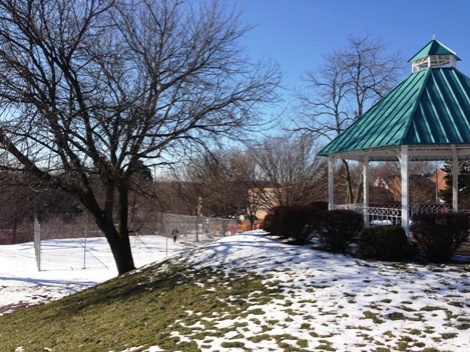
Bon Air Parklet – pavilion in the foreground with a tennis court/dek hockey rink in the snow-covered fenced-in area

Dedicated in 1983 by the citizens of Bon Air, this work memorializes all service men and women of the armed forces.
We bounced away from Bon Air Parklet and the nearby school to make a final loop toward Bon Air Avenue before heading back to the T station. We hadn’t walked the length of Bon Air Avenue initially and we’re glad we took the time to visit the lower (western) part of the stately street.

Bon Air Avenue lined with large family homes across the street from a steep wooded hillside looming above McKinley Park in Beltzhoover
If you didn’t know that a T-station was in Bon Air, well, you’d never know it. The station is on the western side of the Bon Air hilltop on Clanton St. It is relatively new and, as such, meets modern ADA standards for accessibility.
Our train arrived in a matter of moments and after an enjoyable sight-seeing 10-minute ride, we were back downtown.
The Proof
We’re only 5 neighborhoods into this 90 neighborhood exploration (and of course we’re familiar with quite a few more), but we’re seeing what we anticipated; each of Pittsburgh’s neighborhoods offers unique character and helps to make the city such a wonderful place – America’s Most Livable City. Bon Air certainly plays a role in making the city such a livable place.
We’re happy to have met Bon Air and to have seen the qualities that make it a great neighborhood. It’s suburban (or country, depending on who you ask) living with a city address. It’s a residential retreat from the city. It’s a perfect place to call home.




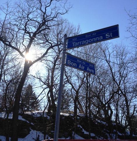
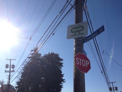




Looks like it was a beautiful day in the neighborhood… and even if it was tricky to get too, sounds like a great place to hang your hat. Thanks for sharing!
You guys seriously need to get the word out about your blog! You do the city such a romantic service! (P.S. I love the captions–“cute house, sweet van” tops the favorites).
Kim- I never heard of Bon Air. Great pictures and Pgh Snap is so cool. I am such a rube in that I don’t know about the new Pittsburgh at all. You guys are dragging me into the new Pittsburgh. Keep up the good work
“I’m goin’ out to the country. That’s where I wanna go! ” Sky scrapers & chicken coops, PGH has it ALL! All kidding aside, yinz two are doing a might fine job of highlighting Pittsburgh’s 90 neighborhoods! Can’t wait to read the next blog!
sorry, im a pain in the butt for such things…but Bon Air is in the city limits. i re-read that one paragraph (about the T’s free zone) – it makes it seem as if you think the “City” is confined within the rivers. although not a big town by square mileage, it does poke out to touch places youd think were not bordering pittsburgh, like mt. lebanon and kennedy townshp.
ok, after reading through your wonderful blog, i realized you know very well what you are doing, and that the wording may have told me one thing, it probably does NOT mean that you were ignorant to the fact that pgh. continues well south of station square! so, sorry for my previous comment (which was in no way meant to be condescending)…thanks!
I grew up in Bon Air and have fond memories of the playground and walking to the elementary school! Great neighborhood!